
http://www.saudiaramcoworld.com/issue/200701/seas.beneath.the.sands.htm
It might seem like a bit of stretch to include an article about the Nubian aquifer in an Egyptology blog, and to be honest it is a bit of a stretch, but today is a low news day, and this might be of interest to anyone who wants to know more about the underlying resources that have supplied the Western Desert oases from prehistoric times onwards:
"Look at a map of North Africa from Egypt to Algeria. Almost everything outside the Nile Valley and south of the coastal plain appears to be lifeless sand and gravel deserts, spotted here and there with oases and rain-catching massifs of uplifted bedrock. But peer deeper, under the sand, and you will find water.
Under the Sahara lie three major aquifers, strata of saturated sandstones and limestones that hold water in their pores like a wet sponge. The easternmost of these, extending over two million square kilometers, underlies all of Egypt west of the Nile, all of eastern Libya, and much of northern Chad and Sudan, and contains 375,000 cubic kilometers of water—the equivalent of 3750 years of Nile River flow. It is called the Nubian Sandstone Aquifer System, and lately it has come to the attention of practitioners of a subspecialty of nuclear science known as isotope hydrology."
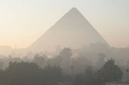
Don't miss the slideshow in the blue "View Photos" box (main picture, top of the page). See the above page for the full story.
No comments:
Post a Comment